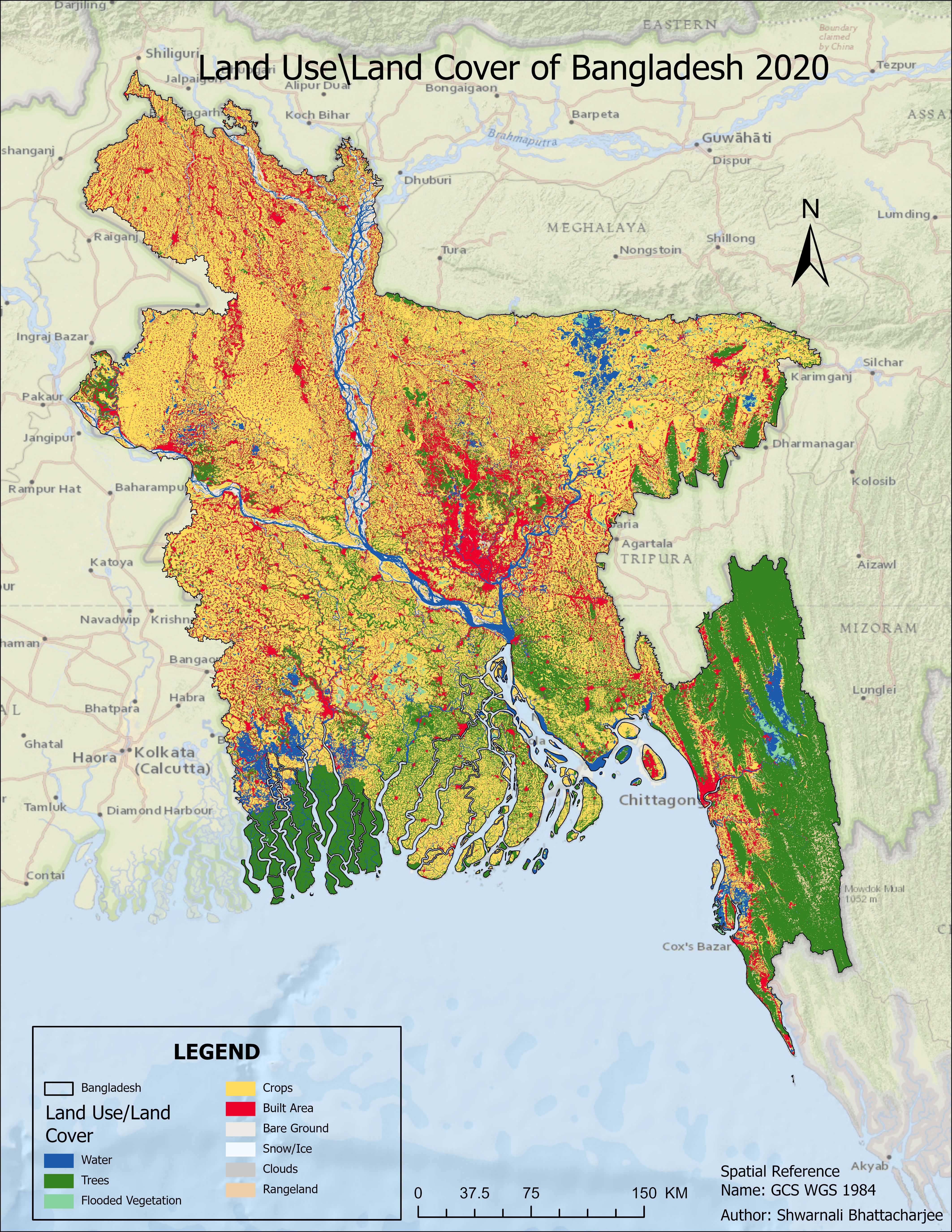
Project information
- Category: Cartography
- Project date: Novemeber, 2022
- Data source: Sentinel 2 (10m)
- Tool used: ArcGIS Pro
For Day 20 of the 30 Day Map Challenge 2022, I decided to create a map showcasing my favorite topic - the land use and land cover of Bangladesh in 2020. Using advanced GIS techniques and data from reliable sources, I was able to produce a detailed and accurate depiction of the different land use and land cover categories in Bangladesh. From urban areas to croplands and forests, this map showcases the diversity and complexity of the country's landscape. I am thrilled with the end result and proud to share it with others who appreciate the beauty and importance of mapping the world around us.