Project information
- Category: ArcGIS StoryMap
- Project date: Fall, 2022
- Tool Used: ArcGIS Pro (Spatial Analyst, 3D Analyst), ArcGIS Online
- Project URL: https://storymaps.arcgis.com/FriscoParks
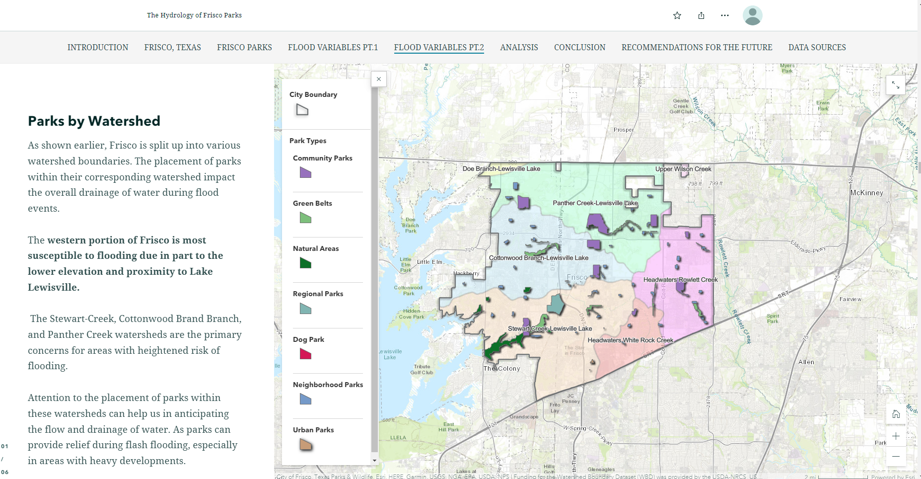
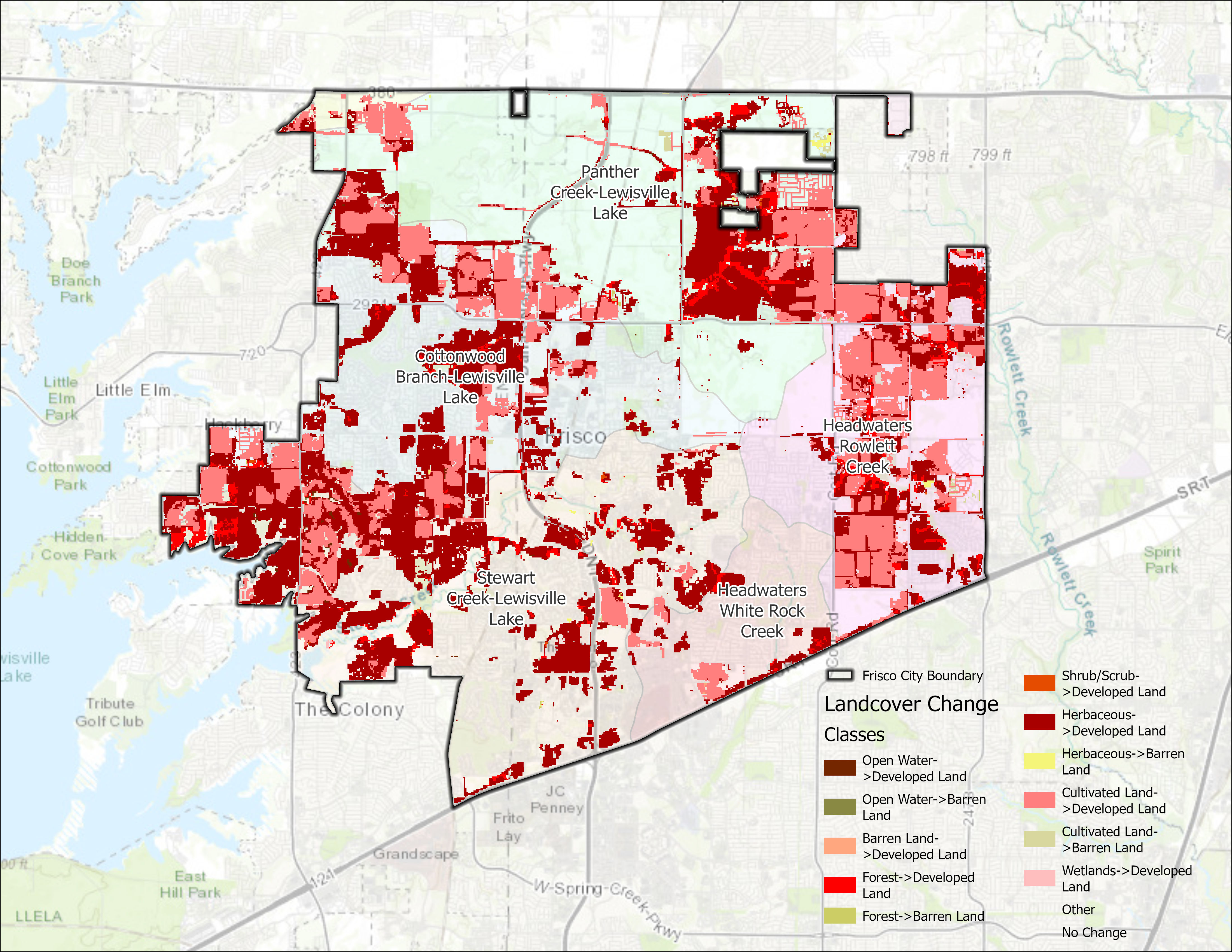
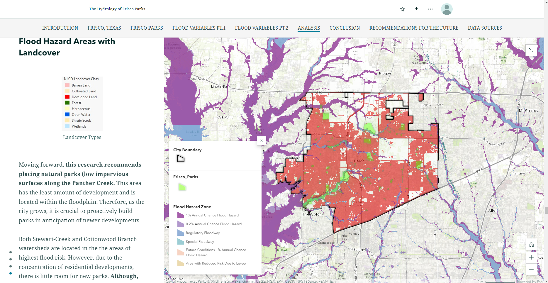
During a Geospatial data visualization and analytics group project, I created multiple maps to assess the use of parks in Frisco City, Texas, for managing flood events. I developed crucial maps, including elevation, slope, land use landcover (LULC), and landcover change detection maps of the city, which were key flood variables in the study. Along with these maps, I generated a comprehensive set of maps solely for the city's parks, utilizing a variety of data sources, such as watersheds, LULC, and FEMA 100-Year floodplain regions. These maps allowed for the identification and evaluation of flood hazard risk areas within the city, aiding in identifying areas where parks could be used to mitigate flooding and protect the surrounding communities. This project provided a chance to apply geospatial analysis and visualization techniques to real-world challenges, and the team's findings could aid future planning and development decisions in Frisco City and other communities experiencing similar flood-related difficulties.