Project information
- Category: Cartography
- Project date: January, 2022
- Data Source: ArcGIS Online, Humanitarian Data Exchange
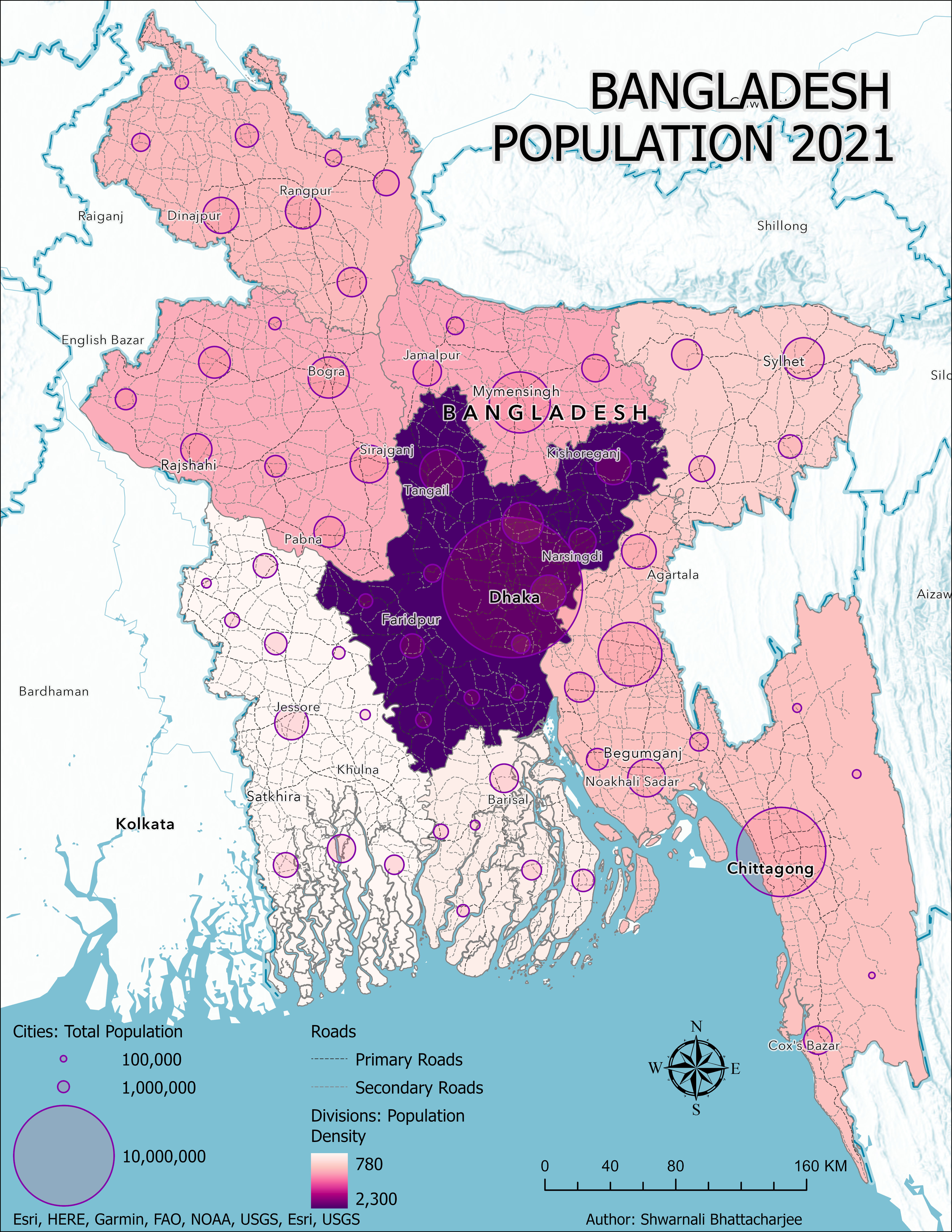
As the 8th most densely populated country in the world, Bangladesh is facing a unique set of challenges related to population growth and distribution. In 2022, the Bangladesh Bureau of Census released new demographic data, providing an opportunity for me to explore and visualize these patterns in greater detail.
Using this data, I was able to create clear and informative maps that highlighted population density by division, as well as total population by city. Interestingly, these maps revealed that Dhaka, one of the eight divisions of Bangladesh, had the highest population density, with a staggering 2,300 people per square kilometer. In contrast, Khulna had the lowest population density, with only 780 people per square kilometer.
